

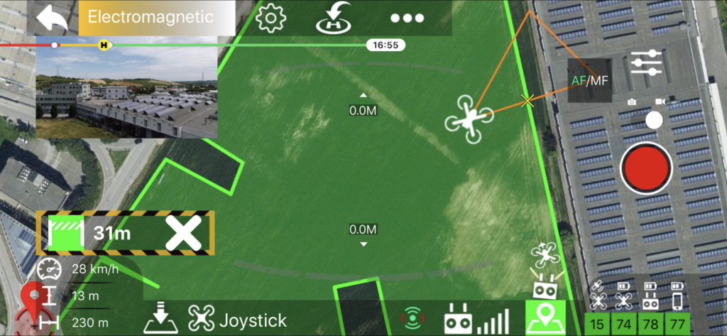
- Virtual Polygonal Geofence (VPG for short) are user-defined geographic areas in which the drone can fly
- They are intended as an alternative to the standard circular distance limit managed by the drone firmware, which is not very useful in most scenarios
- Activating a VPG the application will prevent the drone from flying outside its perimeter, progressively slowing down the drone near the barriers until it stops
Each VPG can also be configured with:
- min altitude
- max altitude
- max drone Pitch and Roll Angle
- max Vertical Speed
- max Yaw Rotation Speed